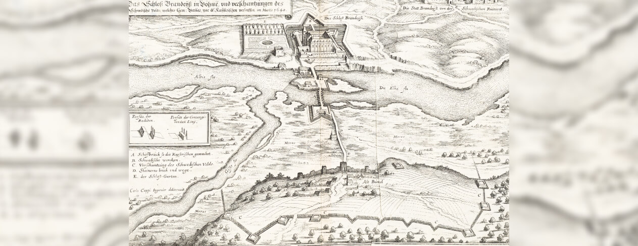
As the author, I was truly delighted to provide my protagonist with something as tangible as a map of the alleged crime scene. The engraving of Brandeis Castle and its surroundings, dating from 1640, is found in the 21-volume Topographia Germaniae by the engraver and publisher Matthäus Merian (1593–1650) and the geographer Martin Zeiller (1589–1661). Fortunately for me, the relevant volume, Topographia Bohemiae, Moraviae et Silesiae, was reissued in a facsimile edition in 1960.
For its time, the Topographia Germaniae was a monumental and high-quality work, richly illustrated with engravings. Owing to its immense popularity, it was widely circulated and republished several times. Thus, it seemed entirely natural to let Father Franz discover a copy in the library of his convent and pass it on to Archduchess Marianne to aid her investigation.
Access to the Metatext via placing an order for an augmented product. See Terms of Use
We use cookies to ensure that we give you the best experience on our website. If you continue to use this site we will assume that you are happy with it.